Session Objective & Outline
This CPD session addresses the urgent challenge of rapid urbanization in secondary cities across Commonwealth nations where professional capacity is critically lacking, presenting a practical “barebones planning” methodology developed by the Prince’s Foundation. The session reveals that while global urban population doubled over 25 years, urban footprint increased 2.5 times, with projections suggesting urban extent will triple by 2050 if current trends continue—creating particular challenges where countries growing fastest (5-6% annually) have fewest professionals, and secondary cities often have no built environment expertise at all. Drawing on 300 years of successful planned city extensions and organic growth patterns, the methodology focuses on establishing the fundamental “spine, matrix, and pattern”: the street hierarchy, urban blocks (50-150m), and walkable neighborhoods (1km diameter, 10-minute walk). The four-step process involves mapping growth area options using constraints analysis, breaking priority areas into street networks and walkable villages, dividing neighborhoods into quarters with focal points, and implementing through demonstration projects. The Bo, Sierra Leone case study demonstrates how this can be accomplished in days rather than years with non-specialist leadership, using accessible tools like Google Earth projections, smartphones for site surveys, and community workshops to secure political commitment through charters and achieve consensus on protecting key infrastructure corridors and green systems for long-term sustainable growth.
Outline
- Context and scale:
Global urban population doubled while footprint increased 2.5x over 25 years with projections of tripling urban extent by 2050; inverse relationship between urbanization rates and professional capacity with fastest-growing Commonwealth countries (Kenya, Uganda at 5-6%) having fewest architects/planners concentrated in primary cities leaving secondary cities without any built environment professionals; over half of global urban growth occurring in Commonwealth with half of that in secondary cities - Theoretical foundations:
Leon Krier’s concept of mature cities based on walking versus post-industrial vertical/horizontal overexpansion; healthy city growth through multiplication of walkable neighborhoods (like cell reproduction) rather than continuous expansion; walkable neighborhood model of 1km diameter (5-minute radius, 10-minute crossing) with mixed-use crossroads and residential quarters; UN-Habitat planned city extensions analysis of 300 years identifying universal spine (street hierarchy), matrix (urban blocks 50-150m), and locally-variable patterns responding to climate, culture, and topography - Barebones planning methodology:
Four-step process starting with mapping growth area options through constraints analysis (flood zones, sensitive ecology, existing settlements) and identifying radial routes; breaking priority growth areas into primary/secondary street networks creating series of walkable villages with green/blue infrastructure threading between; dividing individual neighborhoods into quarters each with focal points connected by green routes, protecting sites for schools, markets, and public services; demonstration projects showing regulatory standards through built examples - Bo, Sierra Leone case study:
Secondary city 175,000 population projected to triple to 520,000 in 25 years with home economics graduate leading planning due to absence of built environment professionals; one-day charter workshop securing political commitment and stakeholder sign-on to short/medium/long-term planning commitments; using Google Earth wall projections and flip charts enabling collaborative mapping at scale with intuitive route-finding and swamp identification; smartphone site surveys with offline Google Earth tiles enabling geo-located photography and accurate feature mapping - Implementation approach:
Key fixes plan identifying non-negotiable elements (primary road network, protected green/blue infrastructure, school/market sites, density gradients from 10,000 people/neighborhood at center to 2,000 at rural edge) that must prevail regardless of detailed regulation capacity; community workshops with landowners securing agreement on rights-of-way and boundaries; symbolic tree planting along proposed avenues involving school children to establish future vision; emphasis that bare bones protect fundamental city structure while allowing flexible land use and building standards regulation
Four Steps to an Urban Plan & Project Timeline
- Writing a Charter for Your Growing City
- Preparing for the Charter Workshop
- Running the Charter Workshop
- Consulting Publicly on the Charter
- Creating the Rapid Growth Plan
- Preparing for the Growth Plan Workshop
- Identifying Growth Areas
- Structuring the Growth Areas into Neighbourhoods
- Implementing the Rapid Growth Plan
- Identifying Landowners & Stakeholders
- Finalising the Growth Plan Workshop
- Demarcating the Growth Plan on the Ground
- Populating the Neighbourhoods
- Preparing for the Neighbourhood Workshop
- Running the Neighbourhood Workshop
- Demonstration Project
The above overview has been extracted from this lecture and the more comprehensive Rapid Planning Toolkit Publication. To access this document, see the additional resources section below.

Learning Outcomes
Learning Outcomes
The sessions learning outcomes were:
- Understand the scale and urgency of rapid urbanisation challenges where urban extent is projected to triple by 2050 with fastest-growing Commonwealth countries having inverse relationship between urbanisation rates and professional capacity, and recognise that secondary cities experiencing half this growth often have zero built environment professionals requiring planning approaches accessible to non-specialists while establishing frameworks for long-term sustainable development.
- Comprehend theoretical foundations of sustainable urban form drawing on 300 years of successful planned city extensions and organic growth patterns, recognizing the universal elements (spine/street hierarchy, matrix/urban blocks 50-150m, walkable neighbourhoods 1km diameter) versus locally-variable patterns responding to climate and culture, and understand that properly planned cities drive economic prosperity through agglomeration while informal settlements have opposite effect.
- Apply barebones planning methodology through four-step process of mapping growth areas using constraints analysis, establishing primary/secondary street networks creating walkable villages with green/blue infrastructure between, dividing neighborhoods into quarters with protected public service sites, and implementing through demonstration projects, recognizing this approach fixes fundamental structure allowing flexible detailed regulation as capacity develops.
- Recognise that walkable neighbourhoods of 1km diameter (5-minute radius, 10-minute walk across) with mixed-use crossroads, residential quarters, and density gradients (10,000 people/neighbourhood at centre reducing to 2,000 at edges) represent fundamental human-scale planning unit enabling daily needs satisfaction through walking, supporting SDG 11 as “convening goal” addressing all other SDGs through integrated sustainable cities approach.
- Utilise accessible planning tools including Google Earth wall projections for collaborative large-scale mapping, smartphones with offline tile caching for geo-located site surveys, community workshops for securing political commitment through charters and landowner consensus on key fixes, and symbolic implementation through tree planting establishing vision for future generations, demonstrating that fundamental planning can be accomplished in days with non-specialist leadership.
Core Curriculum Topics
- Places, Planning and Communities (Urban Planning and Design)
This session fundamentally addresses urban planning at city and neighbourhood scale, emphasising sustainable urban form principles including street hierarchies, block structures, walkable neighborhoods, mixed-use development, density gradients, and green/blue infrastructure integration. The methodology draws on 300 years of successful planned city extensions while providing practical tools for contexts with limited professional capacity, demonstrating that establishing fundamental urban structure (the “bare bones”) enables healthy city growth even where detailed regulatory capacity is limited. - Inclusive Environments (Social, Cultural, Contextual and Economic Drivers)
Throughout the discussion, the speaker emphasises understanding urbanisation as driven by human social nature and economic agglomeration benefits, recognising that properly planned cities drive prosperity while informal settlements have opposite effects. The session addresses capacity disparities where fastest-growing regions have fewest professionals, the concentration of expertise in primary cities leaving secondary cities vulnerable, and the importance of community engagement, political commitment, and local empowerment in planning processes ensuring sustainability and ownership. - Sustainable Architecture (Environmental Systems and Resilience)
The session integrates environmental considerations including protecting flood zones and wetlands for natural water management, threading green and blue infrastructure between neighborhoods, avoiding displacement of existing settlements, and recognizing that planning for sustainable cities (SDG 11) serves as “convening goal” addressing all other SDGs. Case study examples demonstrate how lack of planning leads to health crises (respiratory illness from swamp construction, fire service access failures) emphasizing that urban structure decisions have immediate life-safety and long-term sustainability implications.
SDG Learning Outcomes
- SDG 9: Industry, Innovation and Infrastructure
The discussion emphasises infrastructure as fundamental to sustainable urbanisation, detailing the importance of street hierarchies (primary, secondary, tertiary routes), protecting rights-of-way before informal encroachment occurs, ensuring adequate east-west connectors distributing traffic efficiently, and planning infrastructure including schools, markets, and green routes connecting neighbourhood quarters. The Bo case study demonstrates how inadequate road infrastructure prevents emergency service access with fatal consequences, highlighting infrastructure planning as life-safety imperative alongside economic development foundation. - SDG 11: Sustainable Cities and Communities
This session centrally positions SDG 11 as the “convening goal” most connected to all other SDGs, demonstrating that physical planning for sustainable cities efficiently addresses targets across all 17 goals. The methodology addresses making cities inclusive, safe, resilient and sustainable through establishing walkable neighbourhoods enabling access to daily needs, protecting green and blue infrastructure for climate resilience, planning for appropriate density gradients, and creating frameworks that secondary cities with limited professional capacity can implement immediately while building long-term planning capability. - SDG 15: Life on Land
Throughout the session, speakers emphasise protecting terrestrial ecosystems through constraints analysis identifying sensitive ecology and flood zones where building should not occur, threading green and blue infrastructure between neighbourhoods allowing natural systems to function, protecting wetlands and swamps for water management and food production, and planting street trees establishing future green infrastructure. The methodology demonstrates integrating natural systems preservation with urban growth rather than treating them as opposing forces.
CPD Learning Questions
The following CPD questions forms part of the learning guide for this session. As different Institutions of Architecture across the Commonwealth have different CPD reporting requirements, it is suggested that you retain a copy of your responses to these questions for your records.
- Local Urbanization Assessment: What is the projected urban population growth in your city or region over the next 25 years? How does local professional capacity (architects, planners, engineers) compare to this growth rate, and are secondary cities in your region adequately supported?
- Walkable Neighborhood Analysis: Analyze your local area using the 1km diameter walkable neighborhood model. Can you access daily needs (shops, schools, services) within a 10-minute walk? What barriers exist to walkability, and how could urban structure be modified to create more walkable neighborhoods?
- Barebones Planning Application: If you needed to plan an urban extension in your context with very limited resources and time, what would be the essential “bare bones” elements to fix (street networks, protected green/blue infrastructure, public service sites)? What can be left flexible for future detailed regulation?
- Accessible Tools: How could you apply the accessible planning tools described (Google Earth projections, smartphone site surveys, community workshops) in your context? What local adaptations would be necessary to make collaborative planning accessible to non-specialists?
- Implementation Strategy: What mechanisms exist in your jurisdiction for protecting key infrastructure corridors and green systems before informal development occurs? How could political commitment be secured through charters or similar instruments to prioritize sustainable urban planning?
Presenters
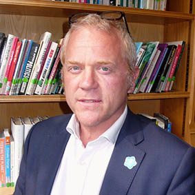
Ben Bolgar, MVO RIBA RIAS
Ben Bolgar, Executive Director – Projects at The King’s Foundation (formerly The Prince’s Foundation) has led over 50 collaborative planning and design frameworks that cover city expansions, new towns, brownfield remediation, town centre regeneration, heritage, ecological and healthcare projects. He has also contributed to many Patronage projects including the Armed Forces Memoria, St. Martin in the Fields, the Royal College of Music, Tintagel Bridge and the National Gallery. Ben is an honorary fellow at the University College of Estate Management, a visiting fellow at Kellogg College, Oxford and a research fellow at Grenoble University. Outside of his role at The King’s Foundation, Ben is Design Director at the development company Stockbridge Land, promoting large mixed-use sites in Cambridge and London.
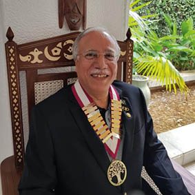
Kalim A. Siddiqui (Session Moderator)
Kalim A Siddiqui is a past President of the Commonwealth Association of Architects, having served from 2020-2022. Outside of his work for the CAA, Kalim is the CEO and Principal Architect/ Planner of the firm since 1997. He Graduated in 1975 from the University of Engineering & Technology Lahore, with a bachelor’s degree in Architecture and then proceeded to earn a Master’s Degree in Human Settlement Planning & Development from The Asian Institute of Technology (AIT) Bangkok, Thailand, in 1979.
Additional Information
The King's Foundation (Formerly, The Prince's Foundation)
The King’s Foundation (formerly, The Prince’s Foundation) is a charitable organisation founded by His Majesty King Charles III in 1990 when he was Prince of Wales. The Foundation advocates for the change His Majesty wants to see in the world, cutting across a range of sectors, disciplines and levels. Across the fields of education and sustainability, farming and agriculture, traditional arts and crafts, health and wellbeing and architecture and urbanism, the Foundation provides education, public services and consultancy in collaboration with a diverse range of individuals and organisations both in the UK and around the world.
References & Resources
To discover more about this project, please feel free to visit:
- https://commonwealthsustainablecities.org/wp-content/uploads/2020/07/Toolkit-design-brochure-v6.pdf
- https://issuu.com/comarchitect.org/docs/survey_of_the_built_environment_pro_1d9f5abd455ca1?fr=sOTY5YjEzNzg1MDY
- https://sdgs.un.org/goals
- https://www.turley.co.uk/news/one-world-link-highly-commended-major-international-planning-award
- https://unhabitat.org/our-city-plans-an-incremental-and-participatory-toolbox-for-urban-planning